Joe Artz sent us the following report concerning the clay layers we observed Saturday. A 10,000 B.C . or early 20th century flood shortly after the stream was straightened (ca. 1917-1923) would explain why we didn’t find any bones in what appeared to be such promising ground.
 Holmes,
We encountered three stratigraphic units (SU’s)–for convenience I’ll call these SU’s 1 through 3, in order of ascending age. All three are channel facies, meaning that they have sedimentary characteristics of having been deposited by swifter currents of water than were encountered in the blue clay where the sloth remains were found.
SU3 is a channel facies that is perhaps correlated with the sloth-bearing (slotheriferous?) blue clay. The blue clay represents a slackwater facies, where clayey sediments settled from suspension in a low energy environment with only very slight currents represented by micromorphologically visible laminations and oriented sand grains. In SU3, the blue-gray colored sediment matrix has sufficient very fine sand that it will not ribbon. There are also macroscopically-visible, discontinuous, laminations and lenses of fine to medium sand with rare pebbles. These materials were deposited near, and possibly within the stream channel.
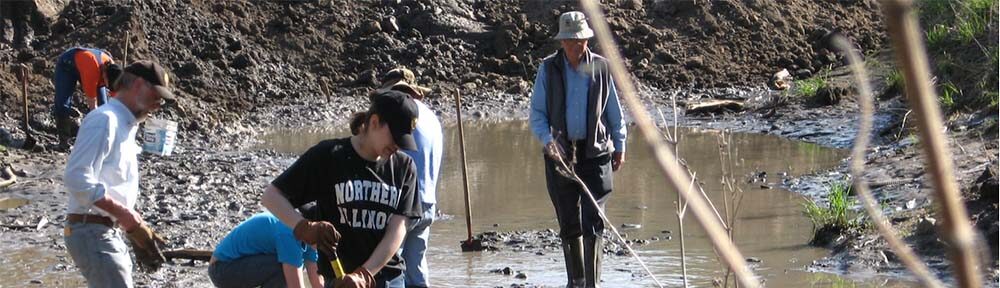
 with Don Wirth and Holmes Semken (R)") SU2 overlies SU3. It is a grayish brown silt loam that is finely laminated. In the south half of the island, SU2 has an abrupt, unconformable boundary with SU3, and appears to fill a small (ca. 1.5 wide by 30 cm deep) trough incised into SU3. This is perhaps an overflow channel scoured by floods and filled with more oxidized sediment that was probably reworked from a nearby, better drained sedimentary facies. The abrupt SU2-SU3 contact fades to the north in the profile, and in the north part of the island, has a conformable contact with SU3. This suggests that SU2 may be contemporaneous with the upper part of SU3. The SU2-SU3 contact trended northwest across the excavated surface, and seems to have been thicker in the west part of the excavated area of the island.
SU2 overlies SU3. It is a grayish brown silt loam that is finely laminated. In the south half of the island, SU2 has an abrupt, unconformable boundary with SU3, and appears to fill a small (ca. 1.5 wide by 30 cm deep) trough incised into SU3. This is perhaps an overflow channel scoured by floods and filled with more oxidized sediment that was probably reworked from a nearby, better drained sedimentary facies. The abrupt SU2-SU3 contact fades to the north in the profile, and in the north part of the island, has a conformable contact with SU3. This suggests that SU2 may be contemporaneous with the upper part of SU3. The SU2-SU3 contact trended northwest across the excavated surface, and seems to have been thicker in the west part of the excavated area of the island.
SU1 was encountered along the north side of the island. It is a laminated blue gray loam or very fine sandy loam. It is similar to SU3, but sandier, less consolidated, with more distinct laminations in the lower part. It yielded finely-divided flecks of bone and small bits of wood, and Euroamerican ceramics (undecorated whiteware). The latter suggests a historic channel fill deposit, perhaps of the 1917 excavated channel, or a post 1917 channel. At the south end of where we’d excavated, SU3 did have a very abrupt contact with what looked like SU2, which clearly indicates a historic age.
Thanks again,
Joe
I’ve long pondered the improbability of 4 ft. of clay accumulating without a break–500 years (?) without a flood?! It’s comforting to find some evidence finally that they were indeed occurring. I expected a more dramatic signature–sand and rocks–but Joe says the small differences seen here aren’t unusual for western Iowa at this time. Flood water transports what’s available, and several thousand years of wind-borne deposits left a thick unstable blanket of loess in the region. The hills literally melted away with the rain and spring thaws and for a long time the Tarkio was thick with loess sludge and not much else. Thanks Joe for a vivid new picture of the Valley. . . . Dave
Dave, Why don’t you find more layers in the clay? Floods are a common event there aren’t they? Annually at least
Good question Trav. I wondered about that myself and had to ask. We would have found them if the water had been perfectly still, but those conditions are rare in Iowa. You need to eliminate wind, current, and especially animals burrowing into the bottom or wading around and stirring things up. Deep lakes are your best bet. The channel here was uneven and shallow in places. It dried out completely sometimes (some of the bones show signs of weathering)—that means erosion and more movement. In winter the shallows would freeze—water and top layers of sediment would fuse and move with the spring thaw. It all adds up to plenty of forces homogenizing the top 9-12 inches and erasing the small annual changes. I picture the layers Joe found as major floods–100-year events, cutting deep enough not to be completely erased by all the subsequent activity.